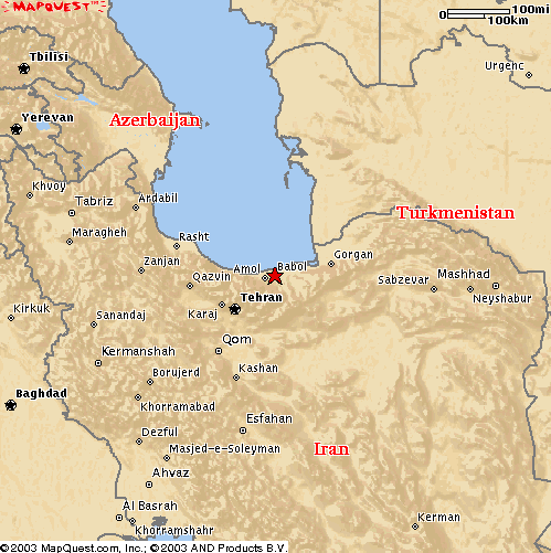
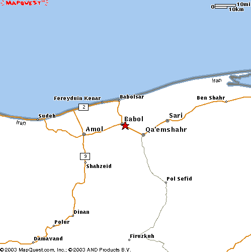
The event occured near a town of Babol, Iran (36.53N, 52.7E) on January 2, 2004 at about 5.30 am local time (2 am UTC=Z).
First, please look at the position of the town of Babol on the maps below:
As the empirical rule shows that geophysical meteors (or geometeors) have
a tendency to occur in association with clouds development, so let's
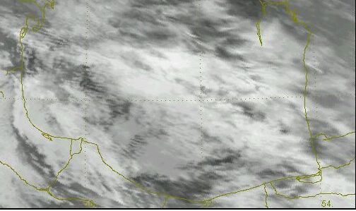
begin with checking cloudiness data. There are pictures by the NOAA-CIRES Climate Diagnostics Center (Boulder, Colorado, USA, from their Web site at http://www.cdc.noaa.gov/). It is seen that there was an increase of cloudiness in the Babol area after the event:
averaged and smoothed for 12-18 Z, Jan.1 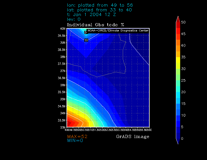
averaged and smoothed for 18-24 Z, Jan.1 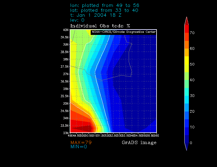
averaged and smoothed for 0-6 Z, Jan.2 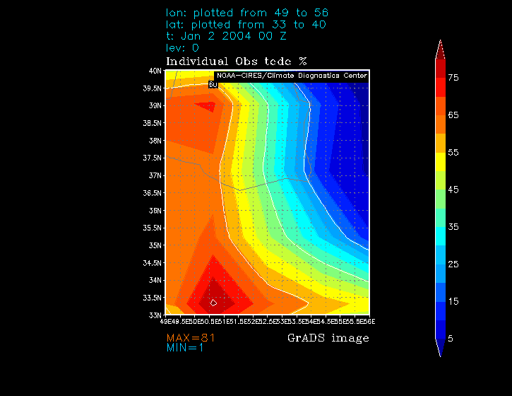
averaged and smoothed for 6-12 Z, Jan.1 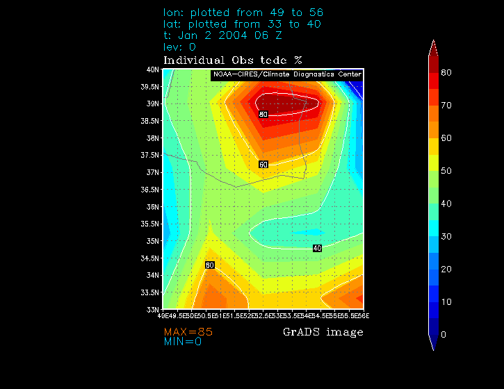
averaged and smoothed for 12-18 Z, Jan.1 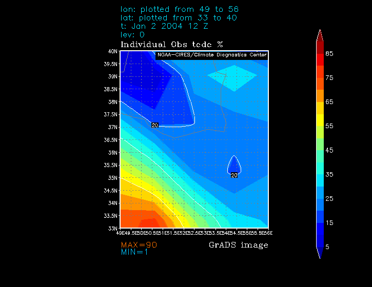
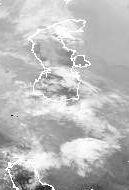
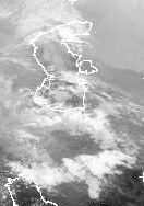
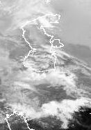
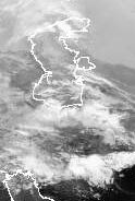
Unfortunately, during smoothing and averaging many important and interesting
features of the cloudiness development were lost. To recover some of them,
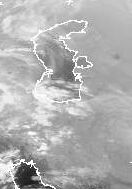
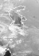
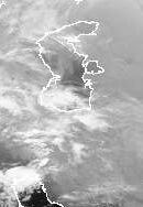
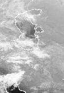
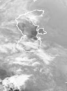
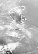
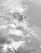
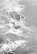
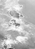
here are METEOSAT-5 satellite's infrared images (taken from Dundee Satellite Receiving Station http://www.sat.dundee.ac.uk/ ) for those times:
 Jan.1, 20 Z
 Jan.1, 21 Z
 Jan.1, 22 Z
 Jan.1, 23 Z
 Jan.2, 0 Z
 Jan.2, 1 Z
 Jan.2, 2 Z
 Jan.2, 3 Z
 Jan.2, 4 Z
 Jan.2, 5 Z
 Jan.2, 6 Z
 Jan.2, 7 Z
 Jan.2, 8 Z
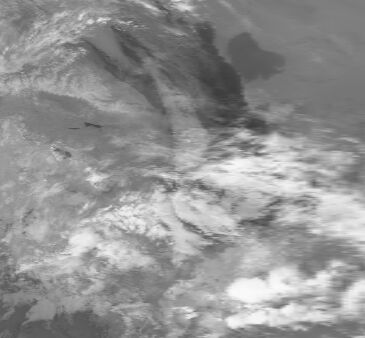
Even on these low-resolution pictures it is possible to see that
the event took place during a short-duration lacuna (or gap or hole)
in cloudiness over the Babol area. Moreover, it seems that the lacuna
was the most deepest when it was over the Babol area at the time of
the event (2 Z).
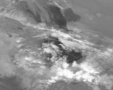
About 2 hours early the lacuna
can be seen with a little bit larger resolution on the NOAA-16 satellite
channel 4 infrared 'equalized'(for better viewing) image (below) taken at
Jan.1, 23.58 Z (from NOAA
Satellite Active Archive System www.saa.noaa.gov). Some minor
cloudiness in the lacuna is surrounded by much more stronger cloudiness
(on the image the center of lacuna is a little bit shifted to the south of
Babol).
Here is another version of the
image, and on this picture you could
see the same view, but just to the north from Babol with better resolution:
On the next such 'equalized' image from NOAA-15 taken on Jan.2, 3.39 Z
the southern border of the lacuna is already over Babol. Upsurge of the cloudiness is commencing.
Pouria Nazemi sent me preliminary weather for a meteostation (WMO number 40736, located at 36.7N, 52.65E) at the town of Babulsar (about 20 km to the north from Babol). It showed the following:
Babolsar:
Day                        Time(UTC)              Temp(C)
Humidity*      Pressure       Cloudiness
---------              ------------              -------
----           --------       ----------
January 1                   21                    9
>90%            1011.8          Clear

January 2                   00                    6.8
>90%            1011.9          Clear

January 2                   02                    7
>90%            1011.9          Clear

January 2                   03                    6.2
>90%            1011.9          Clear

January 2                   04                    8
>90%            1012            Full Cloudy

January 2                   05                    8
>90%            1013            Full Cloudy

January 2                   06                    8.6
>90%            1014.6          Full Cloudy

January 2                   07                    11
>90%            1015            Semi-Cloudy

* 90% < Average humidity < 97%
You can see that the cloudiness data is in complete agreement with seen on the satellite pictures.
According to Pouria, preliminary weather info for a meteostation in the town of Qa'emshahr (about 15 km to the east of Babol) shows the following at about 1.30 Z:
Qa'emshahr
Air pressure: 1028.5 hPa
Temperature: dry=2.4 wet=2 (Deg. C)
Humidity = 93%
No any clouds in the sky.
The info confirms that there was indeed a lacuna in cloudiness at the time of the event. And the humidity was also favourable for appearence of ball-lightning like formations. So the meteorological situation was favourable to geometeors.
Below is a map of earthquakes generated by International Seismological Centre, On-line Bulletin, (http://www.isc.ac.uk/Bull, Internatl. Seis. Cent., Thatcham, United Kingdom, 2001). The earthquakes shown are for 1990s, when seismic equipment became enough sophisticated to pinpoint earthquake's positions more accurately. Earthquakes not far from the Babol area are seen. More dark (black) colors shows areas with higher elevation. As I wrote, observational data hints that a geometeor has a tendency to occur in the areas adjacent to area of high seismic activity, and the Babol event seems to be in agreement with the tendency.
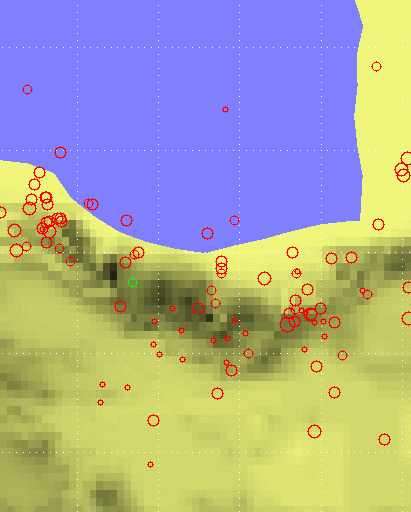
Remarkably that the event occured during a period of powerful and destructive earthquakes in Iran, especially the tragic one near the town of Bam. So it can't be ruled out that the Babol event is somehow connected with the upsurge of tectonic activity. I think that the idea is worth of a special investigation.
LATER ADDITION. From http://www.iiees.ac.ir/English/baladeh_e.html